Bài đăng này xác nhận
quyền sở hữu trang web của tôi và trang web này tuân thủ chính sách
chương trình Google AdSense cũng như Điều khoản và điều kiện:
ca-pub-1550784441625242
Sunday, June 12, 2011
Sunday, May 8, 2011
Scenic Dalat
 | ||
| Thung Lung Tinh Yeu (Valley of Love) is now a park developed by the local government to attract tourists. The valley is approximately 5 km from the center of town. At the floor of the valley is Da Thien lake. To go to the lake there is a small dirt path used for horses. Recently the park attendants have built a series of steps leading to the bottom of the valley. Lake Da Thien is quite small and there are peddles and motorized boats for rent . | ||
Xuan Huong Lake
 | Da Lat is also famous for its many waterfalls and lakes, one of which is Ho Xuan Huong (Xuan Huong lake). This man made lake was a site where many indigenous people of Langbian high land made their homes. In 1984, the lake was emptied for renovation purposes. At the bottom of the lake, scientists found many relics belonging to the hill tribe that once lived in this area. Xuan Huong lake is shaped like the crescent moon. Visitors to Da Lat and the town's people use the lake as a place to meet and talk. The lake is also where many honeymooners come to visit. |
| Xuan Huong lake is the most beautiful lake in Da Lat. It is approximately 5 km2. In 1919 a dam was formed on a branch of Camly river creating a small lake. In 1923, another dam was built further down stream to create yet another lake. During a severe storm in 1932, both dams were destroyed. Between 1934-35, a larger dam was built of boulders (site of Ong Dao bridge today) below the sites of the two previous dam creating one large lake named Ho Lon or Large lake. Ho Lon was later renamed after Ho Xuan Huong, a famous vietnamese poet in the 17th-century. |  |
Da Lat Tourism
 | The first hotel was built in Da Lat around 1907. It was made completely out of wood and was called khach san Ho (Lakeside Hotel - Hotel du Lac). In 1916, work commenced on the Palace hotel. In 1922, the hotel openned to the public. It was the largest and most elegant hotel in this region. |
| Da Lat has many homes built of wood much like the Swiss chalets found in the Alps. It also has many grand villas built by French officials during the early part of the century. Many more villas were built by the South Vietnamese officials in the 60s and 70s. |  |
Da Lat History
 | The first person to explore this region was Mr. Nguyen Thong. Approximately 25 years later, in 1893, Dr. Yersin, a French immunologist discovered Dankia high lands while on an expedition to the Langbian high lands. Dankia is 10 km from the city of Da Lat. This region reminded Dr. Yersin of his homeland, and particularly the similarities between Da Lat's evergreen forests and those in the Swiss Alps. He made the recommendation to the government to form a resort town with health spas for government officials and foreign dignitaries in Dankia. |
| Not long after, Dr. Tardiff, also a French citizen, had an expedition through this region and visited Dankia and Da Lat. He recommended Da Lat to the government due to the favorable water source and locale. At the time, South Vietnam was under French rule, and was known as Cochinchina. The Governor of Cochinchina personally visited Dangkia and Da Lat and decided to take Dr. Tardiff's recommendation. |  |
Travel to Dalat: The Gem of Vietnam's Highlands
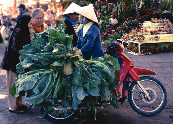 |
| A local woman sells cauliflower in Dalat, Vietnam. |
Vietnam’s Dalat—nicknamed “The City of Love,” “Le Petit Paris,” and “City of Eternal Spring”—has long been popular with Vietnamese and expatriate artists and writers who have taken up residence in villas around town. The area, originally inhabited by the Lat and Ma hill tribes which now live in nearby Chicken Village and Lat Village, increased in popularity during the French colonial era. More than 2,000 beautiful French villas dot the area.
The central part of town is clustered on the northwest side of Xuan Huong Lake where the majority of restaurants, markets, banks, cafes and budget accommodations are found. Footpaths and roads circle the lake, making for easy hikes and bike rides. There are three large cafes built on stilts over the lake. Though better known for their views than food, they do make for convenient rest stops if you decide to make the 3-kilometer hike around the lake.
Dalat is hilly and its sights are spread out, so renting a motorbike or arranging a taxi for a half day or full day is a smart way to see outlying areas. If you select accommodations near Lake Xuan Huong, many sights in town are within walking distance. For outlying areas, Dalat has a unique crew of motorbike guides called Easy Riders. They are all locals, speak fluent English or French, and for $8 per day will guide you around town and the area.
Tuesday, May 3, 2011
Bai Dai Beach Nha Trang

Bai Dai: or Long Beach stretches for 10 km from the southern part of the Lo river along the road from Nha Trang to Cam Ranh Airport. The beach has pristine white sands and shallow turquoise water so its safe for children and non-swimmers. In the summer, travelers can enjoy the tranquil atmosphere and cool breezes whilst lying under the popular trees. However, it can be difficult to find accommodation here. Simple local cafes and restaurants serve a variety of seafood at lower price than in the city of Nha Trang.
How to get there
Take a motorbike or xe om along Nguyen Tat Thanh St. for 10 km from Cam Ranh, then, after passing Dong Bo Mountain, turn off on a smaller to Bai Dai, some 200 meters further on.
Lang Co Beach Hue
 Lang Co Beach is 20 km from Danang and 80 km south of Hue. Lang Co is the most easterly point of Vietnam and is a great place to watch the sunrise.
The beach is a long stretch of fine sand, with a gradual slope and shallow waters. The average sea temperature here is 25 degrees. From here it is easy to reach other great beaches on the Son Tra peninsula. Boats leave from here for Ngoc Island, where there are many aquatic activities on offer.
The Lang Co peninsula is renowned for its myths, history and spectacular landscapes; its where the Chan May and Hoi Cam rivers run into the sea.
Here tourists can enjoy diving, mountain climbing, and expeditions with local fishermen.
This beach in the news
Lang Co is a small fishing village nestled by Hai Van Pass sixty kilometers south of Hue City and forty kilometers north of Da Nang City.
Covering Chuoi (Banana) plain, Ghenh Da (Rocky Bank), and Hai Van Highway, Lang Co Tourism Area is considered one of the four main national tourism destinations in the central region that attract many local and foreign tourists.
In an effort to get rid of the nickname “Forgotten Paradise” given to Lang Co, Thua Thien Hue People’s Committee has paid much effort in organizing the “Legendary Lang Co” Festival in 2005.read more
Photo by fridaycafe
Fortuna Hotel Hanoi
 Everyone passing by Lang Ha street is impressed by the splendid beauty of Fortuna Hotel. And you will also get better impression when staying here. The hotel with 200 rooms will provide you comfortable and convenient place to rest and relax.
In each room, there are modern facilities including telephone, TV and mini bar. Moreover, other services such as dry cleaning and laundry, store and restaurant are always available to satisfy the guests’ demand. The hotel seeks to bring a balance of traditional style and modern comforts to meet the needs of each and every guest.
This combination is one of the factors attracting visitors to the hotel, as the result, the hotel is often full at high season. To make a reservation at the Fortuna Hotel, please enter the dates of your stay and complete our secure online booking form.
How to get there
Fotuna Hotel is the first choice of many guests when coming to Hanoi because of its convenient location. Situated centrally in the embassy and business district of the capital, the Fotuna Hotel is within walking distance to Giang Vo Exhibition Center and 10-15 minutes drive to center of town. Thererfore, you wont miss any big events of business and art at Hanoi when staying in Fotuna Hotel.
Point of view
I have stayed here for 3 weeks while on business and was occupying a premier room where the rooms are large and comfortable. The room comes with a 42-inch LCD TV and a large Jacuzzi bathtub too. The staff were very helpful. If there is a problem, they try to fix it as soon as possible. For instance, they apologized about items I found trivial like a burned out light bulb and the staff replaced it on their own initiative.
Quality control is efficient at this hotel. There are several restaurants featuring several cuisines. The breakfast buffet is international and should satisfy anyone. The local area has many restaurants if you are adventurous.
Staying here on business, I find this hotel very suitable for business meeting because the facilities provided for this purpose, especially large rooms and banquet, are very good. I also recommend this hotel for golf and spa service. It brings me a really relaxing time!
Fortuna Hotel- Ha Noi
Rates: $115-$175
Address: 6B, Lang Ha St, Ba Dinh Dist, Hanoi, Vietnam
Phong Nha / World Heritage
 Geological processes through the ages have bestowed upon Vietnam large areas of limestone. Phong Nha-Ke Bang is representative of such a limestone landscape. Located where the majestic Truong Son range starts, Phong Nha-Ke Bang (Quang Binh province) has within it, numerous inter-linking systems of caves, together with a number of very distinctive underground rivers and streams.
According to data collected in a recent field-study conducted by the British Cave Research Association (BCRA), the total length of the Phong Nha - Ke Bang cave system - as surveyed up to 1997, is 64,386m, comprising 17 separate caverns in two distinct systems, both located in Bo Trach district. The Phong Nha system has 9 caves, with a total surveyed length of 33,758m, while the Vom system has 9, with a total length of 30,627m.
The Phong Nha cave itself (which lends its name to the whole system), in Son Trach village, is probably the most beautiful of all the caves in the region. As studied in 1987, it has a length of 7,729m, and at its maximum point, the ceiling height is 83m. The cave contains many fascinating rock formations, enchanting visitors with evocative names such as Lion, Fairy Caves, Royal Court, Buddha…
The results of their study have enabled BCRA to publish a number of scientifically valuable works about the region. In comparing Phong Nha with other cave systems of the world in general, and of Vietnam in particular, the organization has commented: “Phong Nha, over a 200,000ha. area, has by far the longest underground rivers, the largest caverns and passageways, the widest and prettiest sand banks, and the most astonishing rock formations.”
Nevertheless, Phong Nha - Ke Bang is not famous merely for the marvels of its caves and river, but also for its forests and woods. Research documents from the Institute of Forestry Research have asserted: “The topography of Phong Nha - Ke Bang is a mixture of earth and limestone mountains, with a 90% surface vegetation coverage rate. Of this, 19% by area is occupied by primitive forests, with a huge, and probably unique, biological diversity, containing numerous plants and animals currently listed in the Red Books of protected species of Vietnarn and the world.”
Phong Nha - Ke Bang is also home to the Ruc tribe, only a very small number of which now remains. This is a primitive, cave-dwelling community which, up till only very recently, retained a stone-age way of life and a hunter-gatherer existence.
The Vietnamese Government recently declared Phong Nha-Ke Bang a National Park with 150,000 ha of the area have been placed immediately under the strict management of the local authorities.
After Vietnam joined the international Convention on the Protection of Nature on October 19, 1997, Phong Nha - Ke Bang became one of six regions nominated by the Vietnamese Government to be considered by UNESCO as an official World Natural Heritage Site. Cooperation between the local authorities of Quang Binh province with the Ministry of Culture, the Institute of Forestry Research, and the Ministry of Agriculture and Rural Development have resulted in a comprehensive program to protect and develop this precious natural resource.
Photo by Dust Mason
Subscribe to:
Posts (Atom)